
|
Area/Topic | Bibliography | Background | Hypotheses | Home |
|
Map Page.
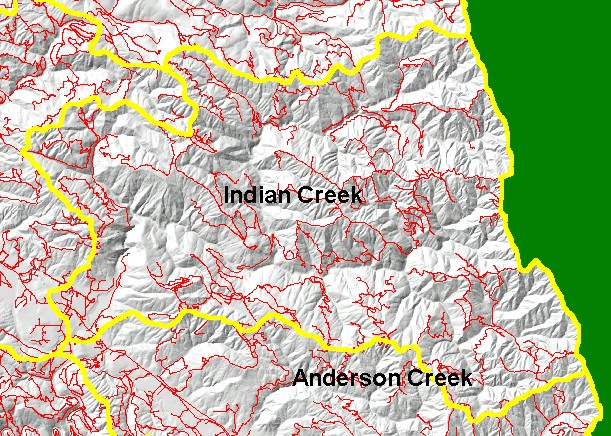
You selected the area Indian Creek and the topic Map: 1H Roads, Indian Creek Sub-basin |
| This is a map of the Roads in the Indian Creek sub-basin, displayed with a Grayscale Hillshade and KRIS sub-basin boundaries. Data provided by the North Coast Regional Water Quality Control Board but generated by U.C. Davis ICE. Greater road densities are related to increased fine sediment yield to streams. | |||
|
|
||
To view metadata about a map layer, click on a link in the table below.
| Name of Layer in Map Legend | Metadata File Name |
|---|---|
| Sub-basins (w/ labels) | subbasins.shp.txt |
| Project Frame | Unavailable |
| Roads (RWQCB) | navroads.shp.txt |
| Topo Map (1:24k scale) | Unavailable |
| Gray Hillshade of Elevtn (TIFF) | grayscale_xnv_light.tif.txt |
| Project Background | Unavailable |
| www.krisweb.com |