
| Area | Mainstem |
| Topic | Sediment: Road Miles Inventoried in Mill Creek 1998-99 |
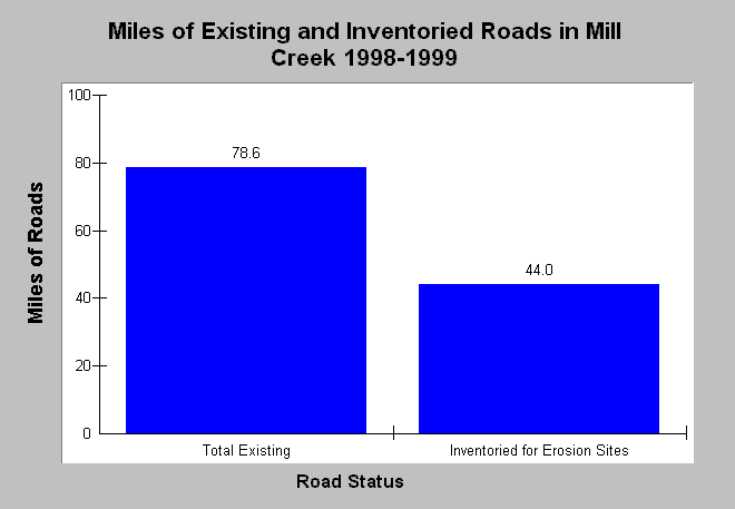
| Caption: This Chart compares the total miles of roads in the Mill Creek watershed with the miles of roads inventoried for erosion sites during Pacific Watershed Associates 1998 and 1999 road surveys. Approximately 56% of the roads in the watershed have been inventoried. Road inventory data were extracted from reports provided by the Mendocino County Resource Conservation District and Pacific Watershed Associates (1998 and 2002), and total existing road miles were calculated by KRIS staff from California Department of Forestry GIS roads layers. See Info Links for more information. | |
 |
To learn more about this topic click Info Links .
To view additional information (data source, aquisition date etc.) about this page, click Metadata .
To view the table with the chart's data, click Chart Table web page.
To download the table with the chart's data, click sed_road_mill_mcrcdpwa_98_99_miles.db (size 18,432 bytes) .
| www.krisweb.com |