
| Area | Mainstem |
| Topic | Sediment: Road Miles Inventoried in Mill Creek 1998-99 |
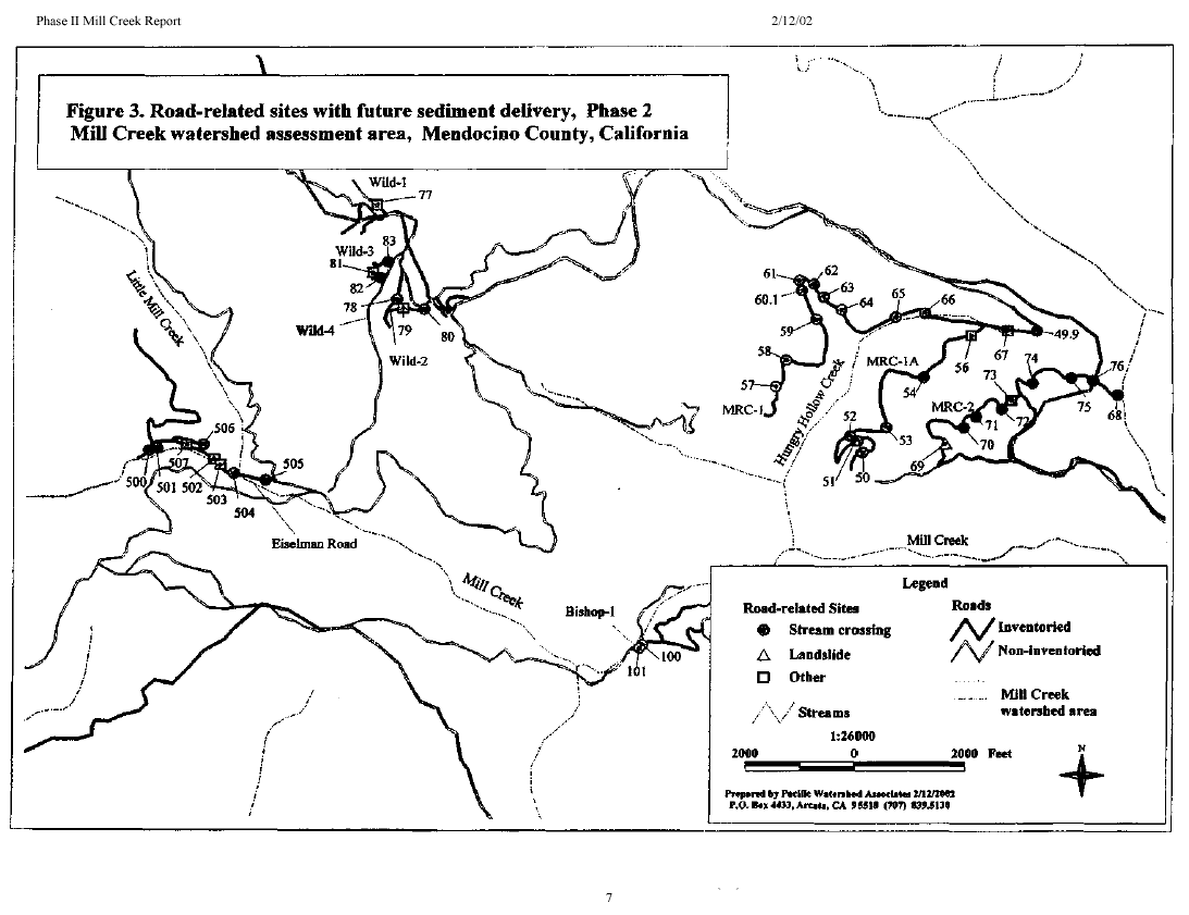
This is a figure from Mendocino County Resource Conservation District and Pacific Watershed Associates (2002) Mill Creek watershed assessment phase II report. It shows the locations of stream crossings, landslides, and other road-related problem sites in the Mill Creek watershed. Seventy-five of the 124 problem sites are stream crossings.
This is a figure from Mendocino County Resource Conservation District and Pacific Watershed Associates (2002) Mill Creek watershed assessment phase II report. It shows the regional location of the project, and the locations of inventoried and non-inventoried roads in the Mill Creek watershed.
This is a figure from Mendocino County Resource Conservation District and Pacific Watershed Associates (2002) Mill Creek watershed assessment phase II report. It shows the locations of road-related problem sites in the Mill Creek watershed, coded by treatment immediacy.
 Click on image to enlarge (36K).
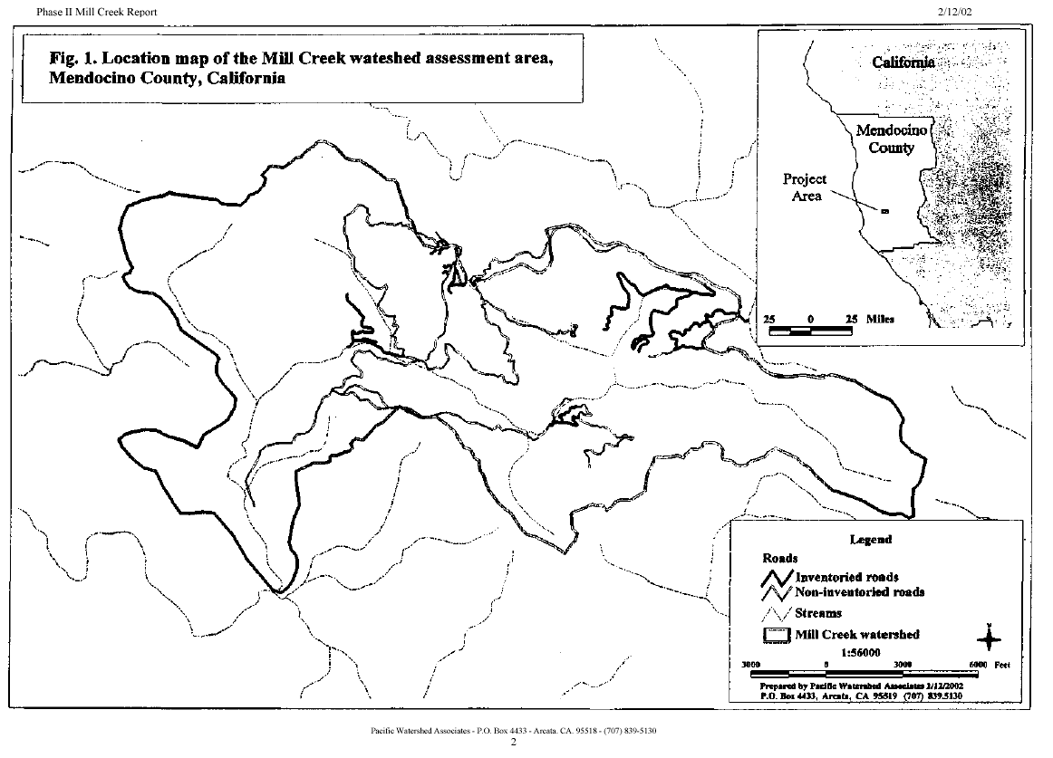 Click on image to enlarge (39K).
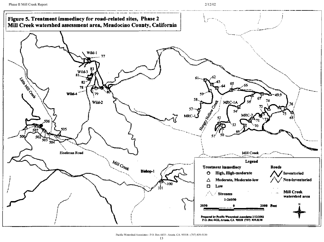 Click on image to enlarge (38K).
To learn more about this topic click Info Links
To view additional information (data source, aquisition date etc.) about this page, click Metadata
| www.krisweb.com |