
|
Area/Topic | Bibliography | Background | Hypotheses | Home |
|
Map Page.
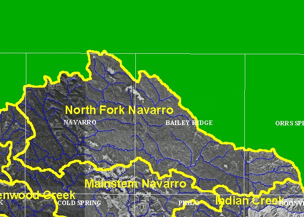
You selected the area North Fork and the topic Map: 3A Digital Orthophotos (DOQs), North Fork Sub-basin |
| This is a map showing digital orthophoto quadrangles (DOQs) in the North Fork sub-basin, displayed with 1:100,000 scale streams. | |||
|
|
||
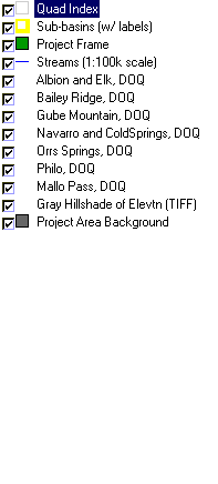
To view metadata about a map layer, click on a link in the table below.
| Name of Layer in Map Legend | Metadata File Name |
|---|---|
| Quad Index | quad_index.shp.txt |
| Sub-basins (w/ labels) | subbasins.shp.txt |
| Project Frame | Unavailable |
| Streams (1:100k scale) | streams100.shp.txt |
| Albion and Elk, DOQ | alb_elk.sid.txt |
| Bailey Ridge, DOQ | baileyridge.sid.txt |
| Gube Mountain, DOQ | gubemtn.sid.txt |
| Navarro and ColdSprings, DOQ | navar_coldsp.sid.txt |
| Ornbaun Valley- Southwest | ornbaun.sid.txt |
| Orrs Springs, DOQ | orrs_springs_sw.sid.txt |
| Philo, DOQ | philo.sid.txt |
| Mallo Pass, DOQ | mallopass.sid.txt |
| Zeni Ridge, DOQ | zeniridge.sid.txt |
| Topo Map (1:24k scale) | Unavailable |
| Gray Hillshade of Elevtn (TIFF) | grayscale_xnv.tif.txt |
| Project Area Background | Unavailable |
| www.krisweb.com |