
|
Area/Topic | Bibliography | Background | Hypotheses | Home |
|
Map Page.
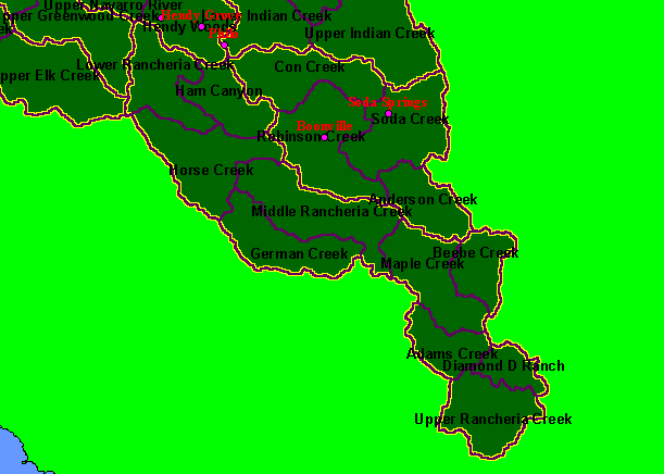
You selected the area Rancheria Creek and the topic Map: 1A Calwater Planning Watersheds, Rancheria Creek Sub-basin |
| This is a map of the ten Calwater Planning Watersheds (black labels) and KRIS sub-basins (yellow labels) in the Rancheria Creek sub-basin, along with a USGS Populated Places theme. Data are from the California Department of Forestry and U.S. Geologic Survey. Scale = 1:280,482 . | |||
|
|
||
To view metadata about a map layer, click on a link in the table below.
| Name of Layer in Map Legend | Metadata File Name |
|---|---|
| Populated Places (1:24k) | pop_places24.shp.txt |
| Calwater PWS (big labels) | calw22.shp.txt |
| Sub-basins (no labels) | subbasins.shp.txt |
| Project Frame | Unavailable |
| www.krisweb.com |