
| Area | South Fork |
| Topic | Temperature: Min, Max and Average Bear Gulch (#22) 1996 |
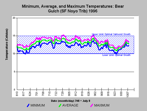
| Caption: The chart above shows the minimum, maximum and average water temperature of Bear Gulch, tributary of the South Fork Noyo River, during the summer of 1996. Temperatures remained within the optimal range for salmonid growth throughout summer. See InfoLinks or Temperature Background page to find information on threshold listed. | |
 |
To learn more about this topic click here .
To view the table with the chart's data, click Chart Table web page.
To download the table with the chart's data, click bgmma96.dbf (size 9,963 bytes) .
To see meta information about the data table used for this topic click here
To view the table with the chart's source data, click Source Table web page.
To download the table with the chart's source data, click noyostrm_temps.dbf (size 5,948,181 bytes)
| www.krisweb.com |