
| Area | Coyote Valley |
| Topic | Land Cover: EPA Land-Use - Coyote Valley Sub-basin, South 1992 |
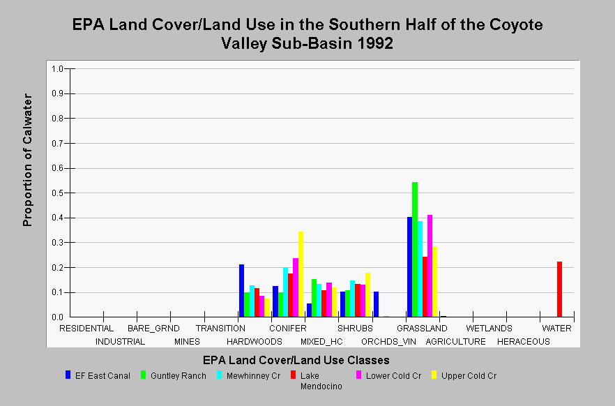
| Caption: This chart displays EPA Land Cover/Land Use data by Calwater Planning Watershed in the southern half of the Coyote Valley sub-basin. Classes are derived from a 1992 Landsat image. These Calwater Planning Watersheds are dominated by grasslands, hardwood, conifer, and shrubs. The Lake Mendocino Calwater contains Lake Mendocino and is shown as 22.3% water. Click on the Map tab to view the EPA Land Cover/Land Use GIS layer. Click on InfoLinks for more information. | |
 |
To learn more about this topic click Info Links .
To view additional information (data source, aquisition date etc.) about this page, click Metadata .
To view the table with the chart's data, click Chart Table web page.
To download the table with the chart's data, click landcover_epa_coyote_valley_1992.dbf (size 2,475 bytes) .
To view the table with the chart's source data, click Source Table web page.
To download the table with the chart's source data, click landcover_epa_russian_calwaters_1992.dbf (size 28,330 bytes)
| www.krisweb.com |