
| Area | Santa Rosa |
| Topic | Land Use: Brush Creek Watershed |
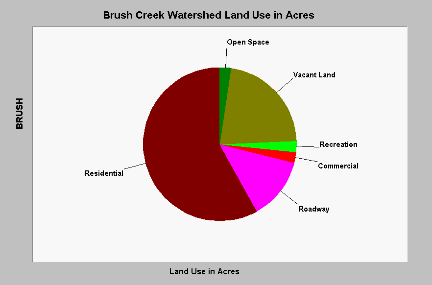
| Caption: This chart shows that approximately 75% of the Brush Creek watershed has been developed. This pattern of development is associated with a large amount of total impervious area in the watershed which increases flood peaks, contributes to down cutting and reduces biodiversity (May et al., 1996). The Roadway category is 100% impervious but the Residential development may vary depending on the extent of landscaping and density of building. Data are from the Sustainable Land Stewardship Institute (2002) and a study performed for the City of Santa Rosa. See InfoLinks for more information. | |
 |
To learn more about this topic click Info Links .
To view additional information (data source, aquisition date etc.) about this page, click Metadata .
To view the table with the chart's data, click Chart Table web page.
To download the table with the chart's data, click impacts_sr_creek_crosstab.dbf (size 672 bytes) .
| www.krisweb.com |