
| Area | Santa Rosa |
| Topic | Land Use: Paulin Creek Watershed |
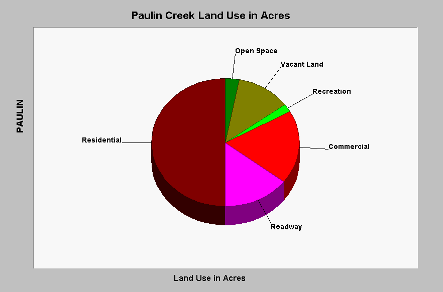
| Caption: This chart shows that Paulin Creek is similar to other Santa Rosa Creek tributaries with more than 75% of its watershed having been developed. The Roadway and Commercial components, which are likely near 100% impervious, make up approximately more than a quarter of the watershed, while residential development is about half. Large amounts of total impervious area (TIA) are likely related to low aquatic diversity as indicated by aquatic invertebrate scores (see Aquatic Insect Topics in this sub-basin). Data are from the Sustainable Land Stewardship Institute (2002) and a study performed for the City of Santa Rosa. See InfoLinks for more information. | |
 |
To learn more about this topic click Info Links .
To view additional information (data source, aquisition date etc.) about this page, click Metadata .
To view the table with the chart's data, click Chart Table web page.
To download the table with the chart's data, click impacts_sr_creek_crosstab.dbf (size 672 bytes) .
| www.krisweb.com |