
| Area | Santa Rosa |
| Topic | Land Use: Piner Creek Watershed |
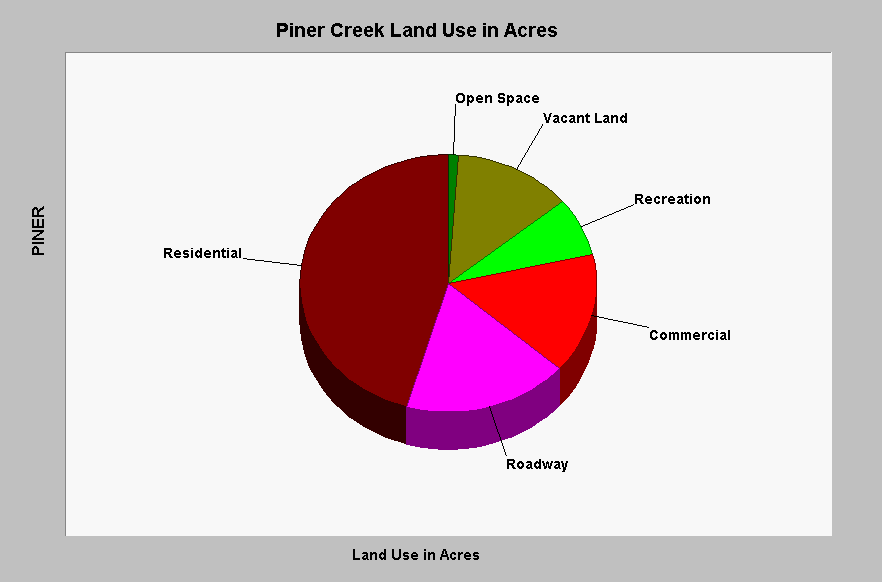
| Caption: This chart shows that more than 75% of the Piner Creek watershed has been developed. The Roadway and Commercial components, which are likely near 100% impervious, cover well over a quarter of the watershed. This amount of total impervious area (TIA) causes increased flood flows and a loss of biodiversity (May et al., 1996). Data are from the Sustainable Land Stewardship Institute (2002) and a study performed for the City of Santa Rosa. See InfoLinks for more information. | |
 |
To learn more about this topic click Info Links .
To view additional information (data source, aquisition date etc.) about this page, click Metadata .
To view the table with the chart's data, click Chart Table web page.
To download the table with the chart's data, click impacts_sr_creek_crosstab.dbf (size 672 bytes) .
| www.krisweb.com |