Photo Database Series Historical Topographic Maps- Alna Area
Click on any thumbnail to see a larger photo.
For detailed information on these photos click here.
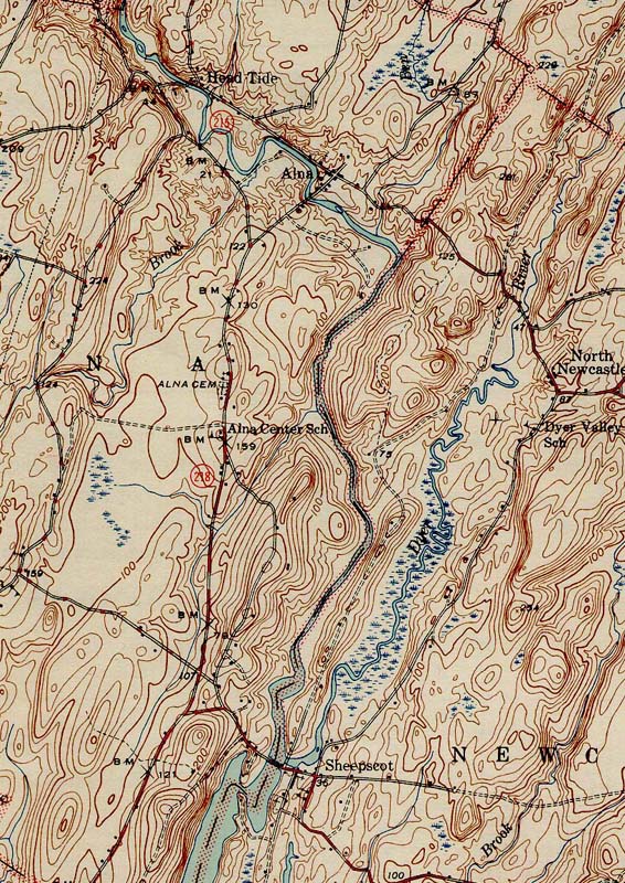
237 KB
1944 topographic map of the Alna area of the Sheepscot River. From the Wiscasset SE 1944 quad downloaded from http://docs.unh.edu/nhtopos/nhtopos.htm.
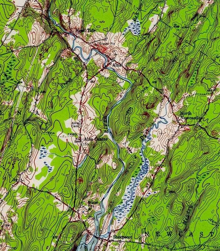
301 KB
1957 topographic map of the Alna area of the Sheepscot River. From the Wiscasset SE 1957 quad downloaded from http://docs.unh.edu/nhtopos/nhtopos.htm.
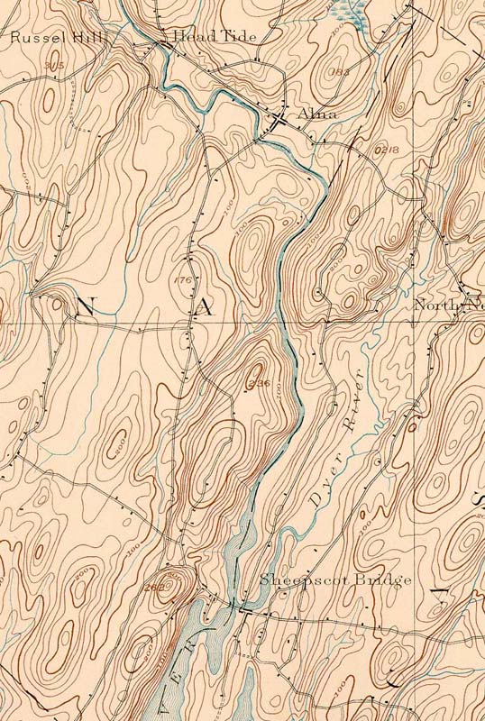
170 KB
1893 topographic map of the Alna area of the Sheepscot River. From the Wiscasset SE 1893 quad downloaded from http://docs.unh.edu/nhtopos/nhtopos.htm.
 301 KB
 170 KB