| Area |
Basin-wide/Regional |
| Topic |
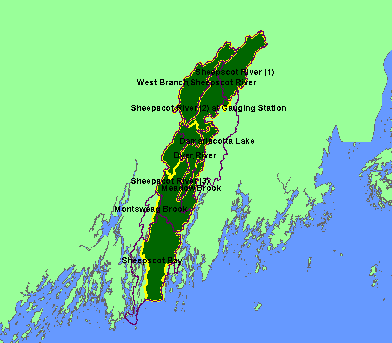
Map: 1C. Level 6 Sub-watersheds (HUCs), Sheepscot River Watershed |
To view a more detailed version of this map click
here
|
This is a map of the Level 6 (12-digit HUCs) subwatersheds in the Sheepscot River watershed, displayed with sub-basin boundaries. Level 6
Subwatersheds are standardized watershed boundaries developed by an interagency team consisting of staff members of USDA-Natural Resource
Conservation Service (NRCS) Maine and Vermont, Maine Department of Environmental Protection, U.S. Environmental Protection Agency (EPA), and
U.S. Geological Survey (USGS).
|
|
|
 |
 |
To view metadata about a map layer, click on a link in the table below.
| Name of Layer in Map Legend | Metadata File Name |
|---|
| Level 6 Subwatersheds (big labels) | wbdme6a3.shp.txt |
| Subbasins (no labels) | subbasins.shp.txt |
| Frame Project Outline | Unavailable |
| Islands | Unavailable |
If you obtain KRIS on a CD and install it on your hard drive as a desktop program, you will have access to increased map capabilities such as zooming in/out, turning layers on/off, adding layers and changing legends.
