| Area |
Basin-wide/Regional |
| Topic |
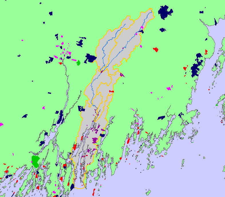
Map: 1F. Land Ownership, Sheepscot River Watershed |
To view a more detailed version of this map click
here
|
This is a map of the conservation properties (not including easements) and public land ownership and leases in the Sheepscot River watershed and
surrounding areas, displayed with KRIS sub-basins. The basin is almost entirely privately owned. Conservation properties data were developed by the
Sheepscot Valley Conservation Association. Public land data were developed by the Maine State Planning Office (MESPO), Maine Cooperative Fish and
Wildlife Research Unit at the University of Maine Orono (MECFWRU) and contributed to KRIS by the Maine Office of GIS
|
|
|
 |
 |
To view metadata about a map layer, click on a link in the table below.
| Name of Layer in Map Legend | Metadata File Name |
|---|
| Public Ownership & Lease Boundaries (1:100k scale) | mepub100.shp.txt |
| Conservation Properties (easements not included) | consfee.shp.txt |
| Subbasins (no labels) | subbasins.shp.txt |
| Mainstem and WB Sheepscot River | shpscotriv24.shp.txt |
| Atlantic Ocean, Bays, and Estuaries | Unavailable |
| Project Area Background | Unavailable |
If you obtain KRIS on a CD and install it on your hard drive as a desktop program, you will have access to increased map capabilities such as zooming in/out, turning layers on/off, adding layers and changing legends.
