
|

|
| Background | Hypotheses | Bibliography | Maps | Home |
|
|
|
| Background | Hypotheses | Bibliography | Maps | Home |
KRIS Web Background Pages: Riparian Areas
![]()
The KRIS Ten Mile database contains canopy cover information from habitat typing surveys provided by the Hawthorne Timber Company (HTC), which acquired Mendocino County timberlands formerly owned by Georgia Pacific Corporation. This information can be used to gauge stream health (see Habitat Typing background page.)Canopy is measured with a densiometer. One problem with canopy information is that is does not indicate riparian over-story conditions, which effect microclimate and large wood recruitment potential.
The KRIS Ten Mile Map project contains forest stand data from the U.S. Forest Service Pacific Southwest Region Remote Sensing Lab (see Vegetation Information in KRIS ) and U.S. Geologic Survey (USGS) digital orthophotos, which both can be used to assess riparian health. The USFS vegetation is shown only in a buffer of 90 meters (297 feet) immediately adjacent to both sides of the stream and shows tree size at the one hectare scale. The 90 meter area was chosen to represent a zone of influence that contributes large wood and helps control microclimate over the stream. The KRIS Ten Mile Map project also assimilated data from ArcView projects provided by Matthews (2000), including a detailed aerial photo image of the entire Ten Mile basin. The latter is useful in riparian analyses.
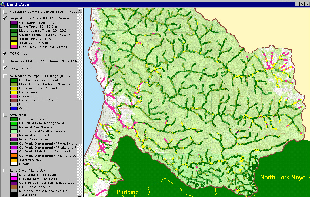 |
This USFS vegetation coverage from the KRIS Ten Mile Map project shows a 90 meter riparian influence zone for the entire Ten Mile basin with a USGS Topo map as the back ground layer. In upper tributaries of the North Fork, riparian areas are characterized as non-forest and early seral conditions because of natural grasslands. The lowest Ten Mile River reaches read as non-forest because they are in the estuary and are surrounded by wetland vegetation. Over all, the dominant condition is early seral with Saplings (1-4.9" diameter), Small Trees (5-11.9" diameter) and Small-Medium (12-19.9" diameter) characteristic of many riparian reaches. Medium/Large trees (20-29.9" diameter) also occur in patches as does Non-Forest associated with timber harvest adjacent to Class III streams. |
 |
Bald Hills Creek in the North Fork Ten Mile drainage represents one of the healthier small order tributaries with regard to riparian conditions. The image at left shows USFS vegetation coverage as a 90 meter riparian influence zone. Small Trees (5-11.9" diameter), Small-Medium (12-19.9" diameter) and Medium/Large trees (20-29.9" diameter) are all well represented. View from KRIS Ten Mile Map project. |
 |
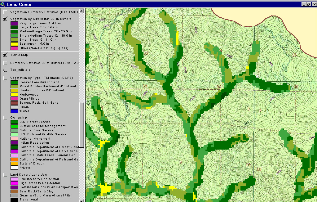
The riparian zones of the upper North Fork Ten Mile River and Patsy Creek show substantial Non-Forest and Sapling (1-4.9") conditions when viewed using a 90 meter USFS vegetation coverage derived from 1994 Landsat imagery. This condition is natural because of grasslands that occur in this area due to earthflow terrain. The grasslands have some oak and other riparian species near the stream, but they are averaged by the USFS scheme at the one hectare scale to Non-Forest in some reaches. Grasslands and non-forest also show in white on the USGS Topo. |
 |
This aerial photo shows the same view as the riparian vegetation map above. The change in vegetation is clearly defined in the photo. The area to the east (at right) is underlain by Central Belt Franciscan terrain as opposed to the Coastal Belt formation which characterizes the rest of the basin. Photo mosaic created by Matthews (2000) using 1999 aerials. View from KRIS Ten Mile Map project. |
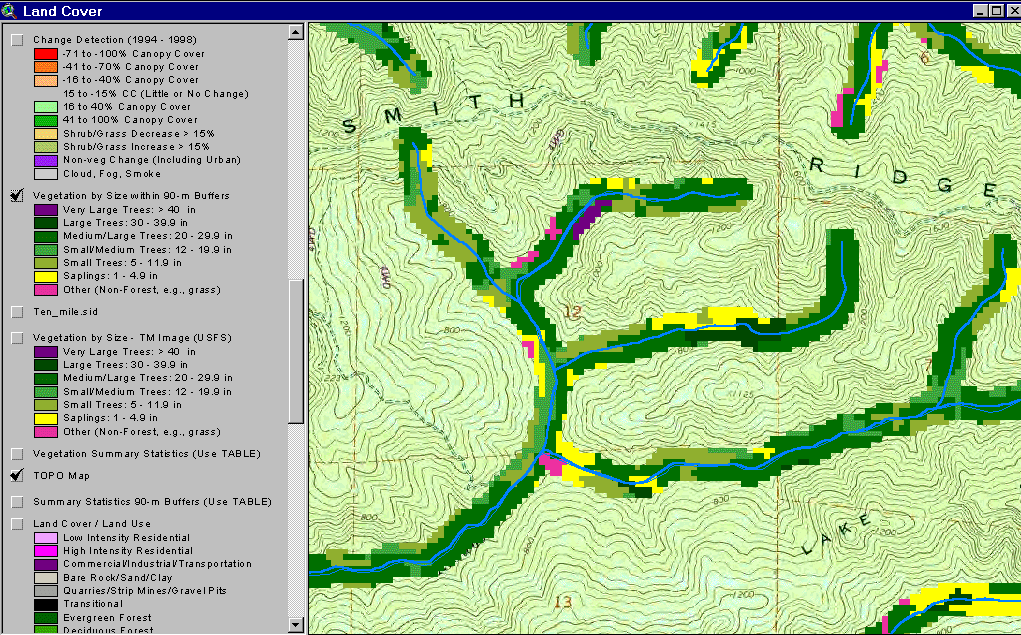 |
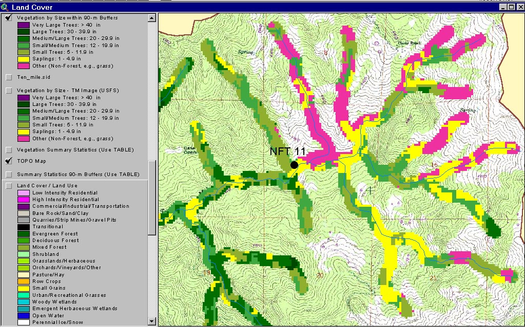
The riparian community of the North Fork of Redwood Creek shows many different size classes of trees and some Non-Forest when viewed using a 90 meter USFS vegetation coverage derived from 1994 Landsat imagery. Tree sizes span the full range from Saplings (1-4.9" diameter) to a small patch of Very Large Trees (>36" diameter). View from KRIS Ten Mile Map project. |
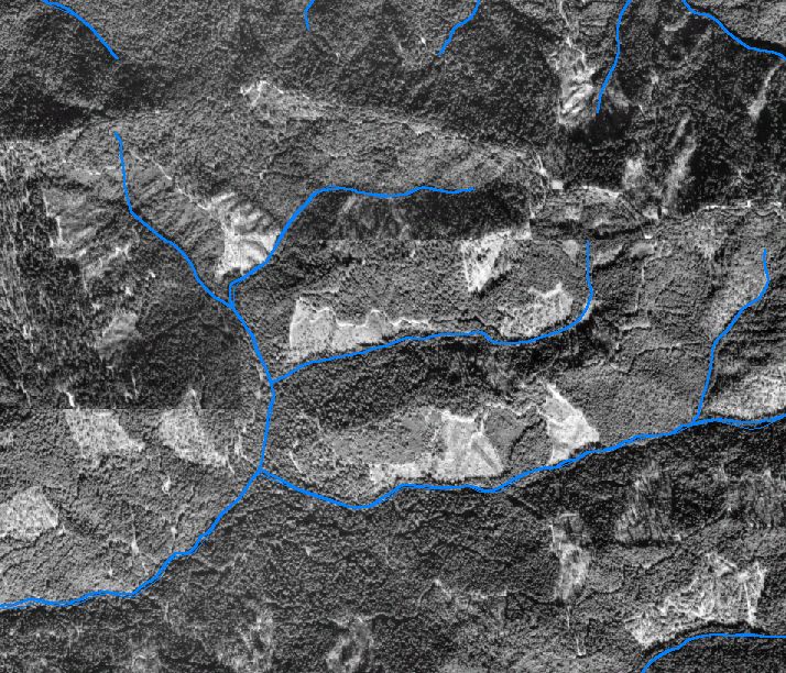 |
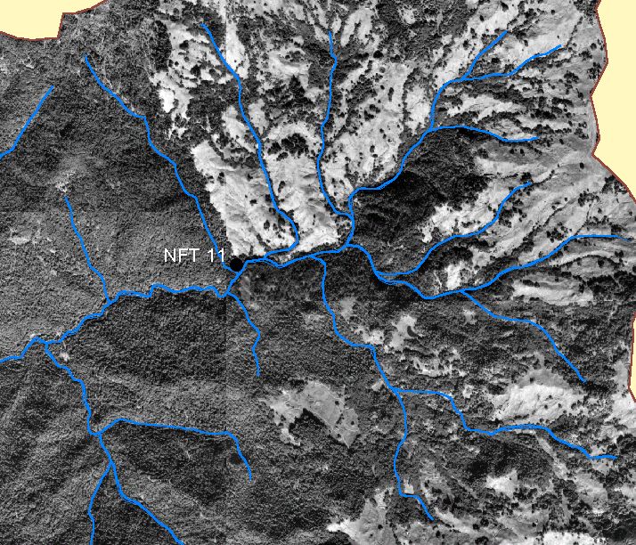
This aerial photo shows the same view as the riparian vegetation map for NF Redwood Creek (above). The image shows early seral vegetation types resulting from recent timber harvests close to the stream. Photo mosaic created by Matthews (2000) using 1999 aerials. View from KRIS Ten Mile Map project. |
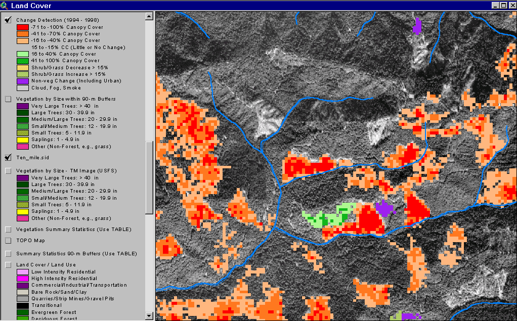 |
The image at left shows the same aerial photo image of the North Fork Redwood Creek as the one above but this one has a "change scene detection" overlay. This layer, derived by comparing 1994 and 1998 Landsat images from the California Department of Forestry (Fisher, 2001), shows substantial changes in riparian conditions since 1994 associated with timber harvest. See Vegetation Types for more information on change scene detection. |
![]()
References
Georgia-Pacific
Co. 1996. Habitat typing inventory reports: Ten Mile River Watershed. Surveys
conducted during 1994/95. Unpublished file memo. Fort Bragg, CA. 103 pp.
Keithley, C. 1999. Evaluating Stream and Watershed Conditions in Northern California. Prepared for the California Department of Forestry, Fire and Resource Assessment Program. Sacramento, CA. 17 pp.
Schwind, B. 1999. USFS Thematic Mapper Landsat Vegetation Coverage Background Information. USDA Forest Service. Pacific Southwest Region Remote Sensing Lab. Sacramento, CA.
Warbington, R., B. Schwind, C. Curlis and S. Daniel. 1998. Creating a Consistent and Standardized Vegetation Database for Northwest Forest Plan Monitoring in California. USDA Forest Service. Pacific Southwest Region Remote Sensing Lab. Sacramento, CA.
![]()
| www.krisweb.com |