 |
Battle Creek Overview | Bibliography | Home | |
Lack of Accuracy of Battle Creek Hydrology Layer Constrains Analysis
|
Battle Creek Overview | Bibliography | Home | |
Lack of Accuracy of Battle Creek Hydrology Layer Constrains Analysis
![]()
A quantitative analysis of riparian conditions using Landsat vegetation was not possible for KRIS Battle Creek V 2.0 because of the problems with accuracy of hydrography data. Kier Associates (2003) attempted to statistically summarize tree size and vegetation types in a 100 meter band on both sides of the stream, but could not do so accurately because the center lines of the 1:100,000 scale U.S. Geologic Service hydrologic maps were often incorrect. as a result, upland vegetation was included in the riparian summaries and stands that were actually within 100 meters of the stream were excluded (see below). The errors did not occur across the watershed, but were of sufficient frequency to make data unreliable for statistical purposes.
Another problem with the 1:100,000 USGS hydrologic GIS data is that it lacks detail, such as stream arcs not extending to headwater areas. In sum, the actual Battle Creek stream network is substantially under-represented, which in turn skews other statistics used for analysis, such as near stream roads and road-stream crossings.
|
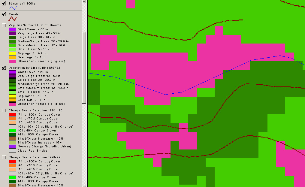
This map image is of the South Fork Digger Creek. The blue line represents USGS 1:100,000 hydrology data, brown dotted lines are roads and colors denote different tree sizes and vegetation types according to 1996 Landsat imagery as interpreted by the U.S. Forest Service Spatial Analysis Laboratory (see Battle Creek Vegetation). The Medium-Large trees (20-29.9" dbh) (dark green) are actually near the stream, but the stream arc is shown as running through a Non-Forest area (pink). See the same location in a USGS ortho photo below. Road data were assimilated from Sierra Pacific Industries, USFS, USGS and Lassen National Park. Map is from KRIS Battle Creek v 2.0. |
|
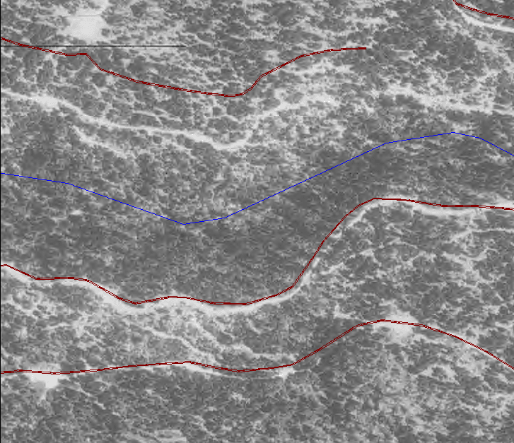
The same USGS 1:100,000 streams coverage and road information as above are shown here, on top of a USGS ortho photo. The stream clearly is outside the riparian boundary and the road layer is also displaced to the north from its actual location (top in photo). Notice how the road, skid trails and temporary roads combined to result in the Non-Forest signature. Although the stream center line and road at top appeared displaced as if the ortho photo had projection problems, the roads in the lower half of the image have the correct center line. It appears that the road at the top was digitized to remain parallel to the incorrect stream location. |
![]()
Reference
Kier Associates. 2003. Use of Spatial Data for Battle Creek Watershed Conditions Assessment. Produced for use of Terraqua, Inc. for the Battle Creek Watershed Assessment. 37 p.
![]()
| www.krisweb.com |