
| Area | Basin-wide |
| Topic | Hydrology: Percent Rain on Snow in Battle WA Sub-Basins |
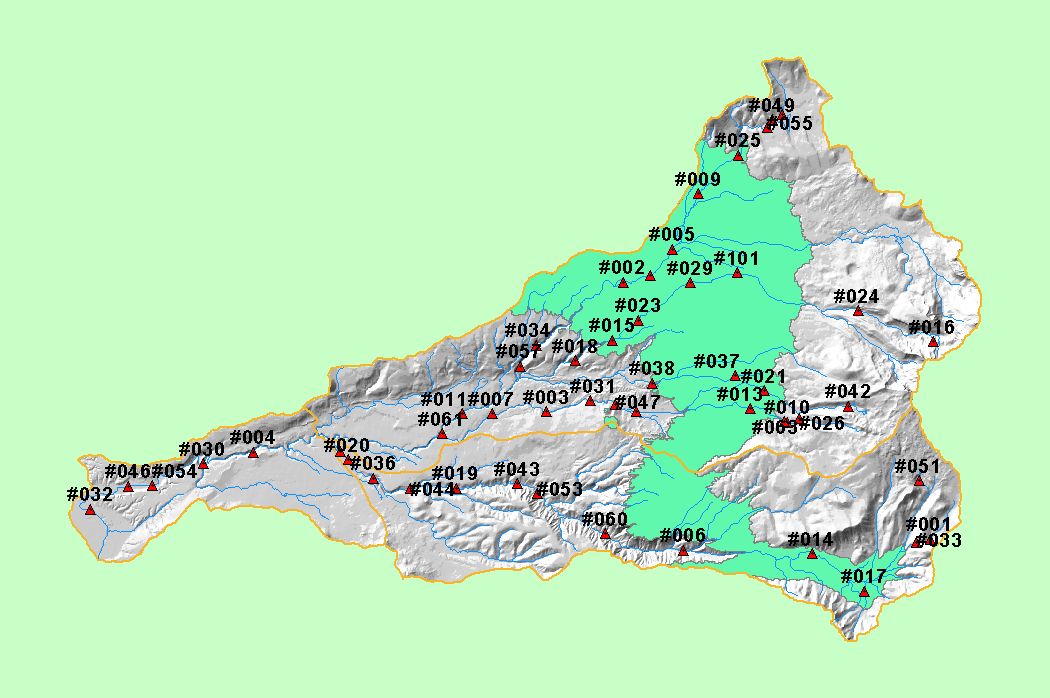
| This map shows the areas in the Battle Creek basin in the rain-on-snow zone (3500 to 5000 feet in elevation), displayed with KRIS sub-basins, 1:100,000 scale streams, and an elevation hillshade. Also shown are locations sampled as part of the Battle Creek Watershed Assessment (Terraqua, 2004). | |||
 |
 |
||
To view metadata about a map layer, click on a link in the table below.
| Name of Layer in Map Legend | Metadata File Name |
|---|---|
| Watershed Analysis Sample Sites (labels) | samplesites.shp.txt |
| Watershed Analysis Sample Sites | samplesites.shp.txt |
| Sub-basins (no labels) | subbasins.shp.txt |
| Sub-basins (no labels) | subbasins.shp.txt |
| Streams (1:100k scale)(no labels) | stms100.shp.txt |
| Rain on Snow Band (3500' - 5000') | rnsnow.shp.txt |
| Grayscale Hillshade | grayscale_light.tif.txt |
| www.krisweb.com |