
| Area | Basin-wide |
| Topic | Sediment: Road Densities by Battle WA Sub-Basin |
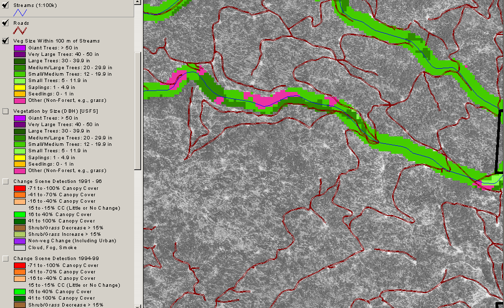
This USGS ortho photo is displayed with USFS 1996 Landsat derived tree size and vegetation type data (one hectare scale) for the riparian zone and roads at a mid-elevation location. Note that main haul roads under-represent disturbance which could cause increased sediment yield or peak flow. The Non-Forest signature (pink) in the riparian appears to be increased in riparian zones by road location near the stream. Roads data from SPI.
This is a zoom in on a USGS ortho photo on upper South Fork Battle Creek near Cold Creek showing road-stream crossings in yellow. Major haul roads create disturbance, but landings and skid trails may add to cumulative watershed effects potential. See Info Links for more information.
 Click on image to enlarge (343K).
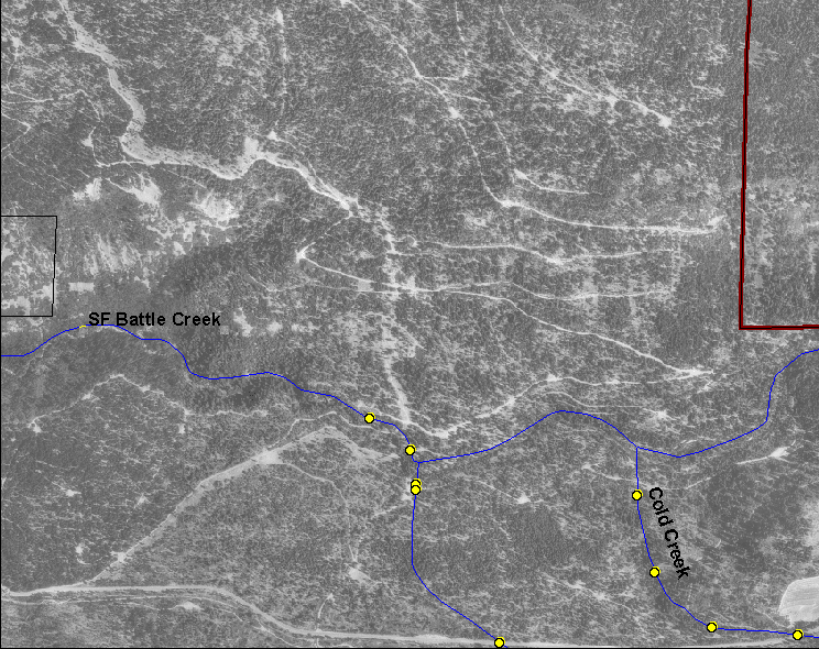 Click on image to enlarge (344K).
To learn more about this topic click Info Links
To view additional information (data source, aquisition date etc.) about this page, click Metadata
| www.krisweb.com |