
| Area | Basin-wide |
| Topic | Sediment: Road Crossings/Stream Mile all Battle WA Sub-Basins |
This map shows the northern portion of the Battle Creek watershed, the 3500'-5000' rain-on-snow susceptible watershed area in light blue (based on Armentrout et al., 1998), roads and road-stream crossings. Fewer impacts are likely in some North Fork Battle Creek sub-basins because of resistant bedrock geology. Road densities may appear higher in mid-elevations because Sierra Pacific Industries provided road data that are more detailed and accurate that USGS or USFS maps that were used in the upper and lower watershed. See Info Links for more information.
This map view shows rain-on-snow risk (3500-5000 feet) in light blue and roads in the southern Battle Creek watershed. High numbers of road crossings occur on upper South Fork tributaries around Mineral due to State higfhway intersections and at mid-elevations on private industrial timber land, such as Onion and Digger creeks. See Info Links for more information.
This map zoom shows riparian conditions (100 m) according to 1996 Landsat data as interpreted by the USFS, roads and road stream crossings near Soap Creek in the South Fork Battle Creek watershed. Note the high number of crossings in the tributary immediately to the north of Soap Creek, which could contribute to a high, local cumulative effects risk. See Info Links for more information.
 Click on image to enlarge (476K).
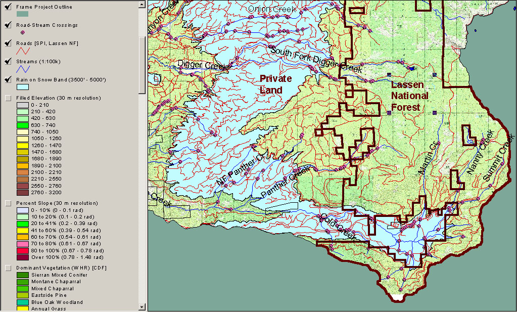 Click on image to enlarge (440K).
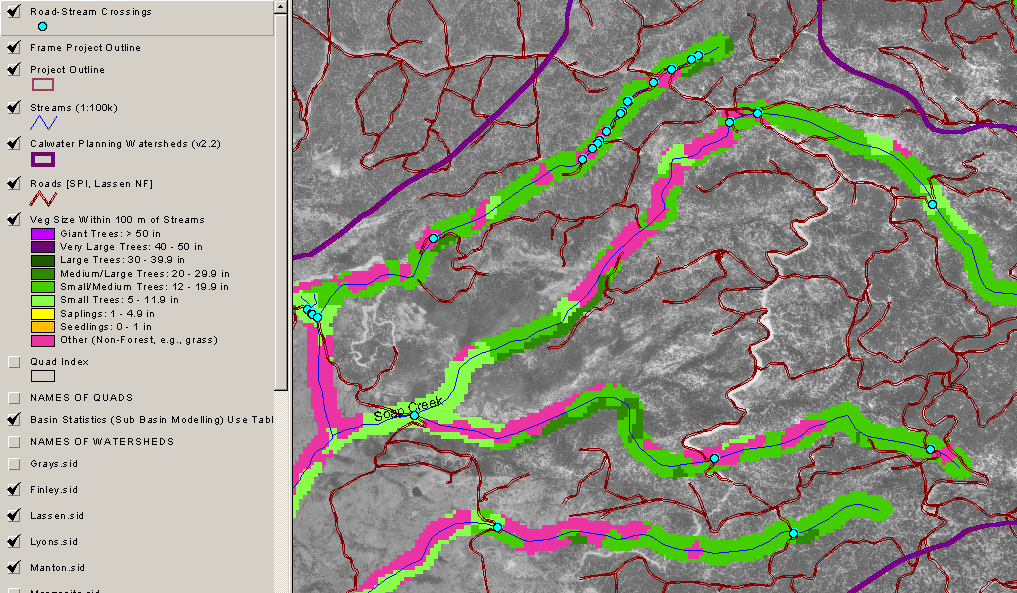 Click on image to enlarge (282K).
To learn more about this topic click Info Links
To view additional information (data source, aquisition date etc.) about this page, click Metadata
| www.krisweb.com |