Bibliography Background About KRIS
Hypothesis #3: High water temperatures in some reaches of the Ten Mile River basin limit coho salmon production.
Support for hypothesis from the literature
Two recent studies conducted in northern California found that coho salmon were at extremely low abundance or absent in streams where floating weekly maximum (FWM) temperature exceeded 18.30 Celsius one or more times during the season (Welsh et al., 2000; Hines and Ambrose, in review). Welsh et al. also found that coho salmon had not persisted in streams of the Mattole River where floating weekly average (FWA) temperature exceeded 16.80 Celsius. Welsh et al. called the annual maximum of floating weekly average temperature the maximum weekly average temperature or MWAT, which is how it is used in KRIS. This is not to be confused with the temperature stress threshold of the same acronym described by Armor (1991). For more information on tolerance of coho and other Pacific salmon species, please see the Temperature page.
From Ten Mile River Data and Documents
Hines and Ambrose (in review) studied the relationship between temperature and coho at presence for numerous streams in the holdings of the Georgia Pacific Company (now Hawthorne Timber Company). The study covered 26 sites within the Ten Mile River basin, most of which have received continued monitoring by Hawthorne Timber Company (HTC). These biologists found that coho salmon were absent from many locations in the Ten Mile River basin, particularly those further inland from the coast, even though stream gradients were suitable for coho and there were no impediments to migration. A statistically significant relationship was found between absence of coho salmon and water temperatures that exceeded a maximum weekly maximum temperature of 18.3° C. Locations concluded to be too warm to support coho salmon rearing included mainstem reaches of the South Fork, Middle Fork and North Fork Ten Mile River.
Numerous reports have been published on Ten Mile River monitoring by Georgia Pacific and Hawthorne Timber Company (Ambrose et al., 1996; Ambrose and Hines, 1997; Ambrose and Hines, 1998). Ambrose and Hines (1997) point out that "a number of variables influence stream temperature in the Ten Mile River watershed, including shade canopy, climatic conditions, stream flow, background variability, local air temperature, channel morphology, topography, stream substrates, channel width, pool frequency and coastal maritime influence. Additionally, a stream's volume, depth, and turbulence affect the actual temperature at any point in the water column due to the high heat capacity of water."
California Department of Fish and Game (1961) noted that coho salmon inhabited the entire South Fork Ten Mile River and that coho comprised more of the fish community in the lower reaches than in the upper reaches. Stream gradient in the South Fork and other areas of the Ten Mile basin show that optimal gradient for coho salmon (<2%) actually occurs mostly in mainstem reaches and tributaries are often too steep for spawning and rearing. Both these factors indicate that coho have historically used mainstem reaches of the Ten Mile River. That reaches formerly inhabited are now too warm to support coho is consistent with the hypothesis that high water temperature is limiting coho production. The cumulative effect on coho rearing is that mainstem reaches are too hot to support them, while tributaries are cool enough, but too shallow.
From KRIS Maps
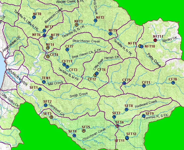 This image from the KRIS Ten Mile Map project shows the location of HTC temperature data collection stations with color codes indicating if maximum weekly floating average temperature exceeded 16.8° C in no years (blue), some years (yellow) or all (red) years measured. Actual years measured in the period 1993-2001 varied among sites. Most tributaries and low order, upper reaches of mainstems are cool enough for coho, except for the upper North Fork, which flows from grassland areas near Patsy Creek. Intermediate and lower reaches of the South Fork and Middle Fork are not likely to support coho due to temperatures over threshold in some years.
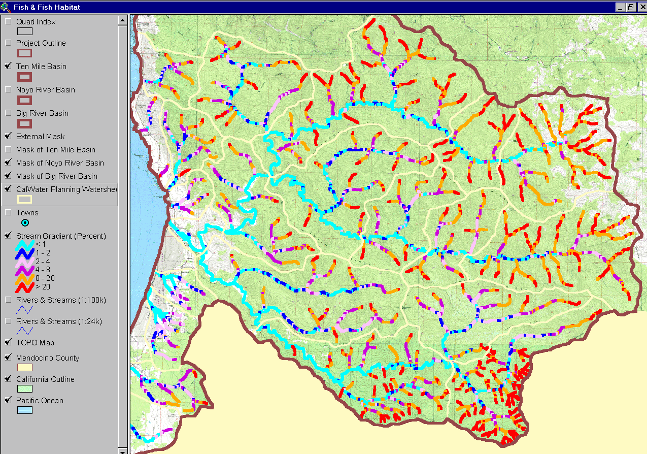 This image from the KRIS Ten Mile Map project shows stream gradient the Ten Mile River basin. Note that the mainstem North Fork, Middle Fork, and South Fork comprise the majority streams with gradient <2% (light or dark blue) and that only a few tributaries like Churchman, Redwood and Bear Haven Creeks, as well as the Little North Fork, have long low gradient reaches. Cooler temperature in the mainstems of the Ten Mile River could allow for a much greater carrying capacity for coho salmon. Coho would have thrived in most of these reaches historically if input from streams was cooler and riparian zones with large coastal redwoods shaded even the larger stream channels.
KRIS Ten Mile Database Source Topics: The charts below are derived from the Topics listed here. Check these Topics in the KRIS database to see the information in context and to access the Info Links and Metadata. These topics and charts contain data provided by Hawthorne Timber Company.
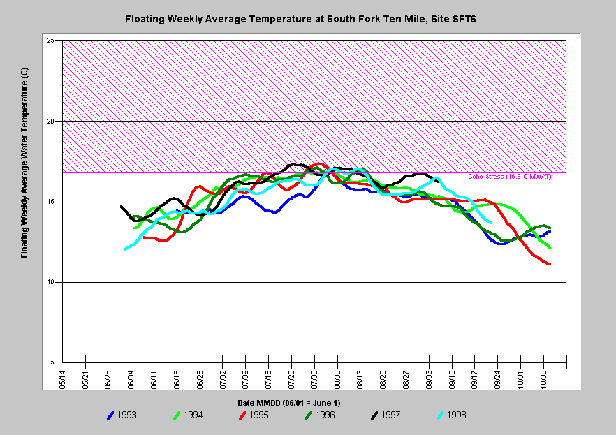
(SF) Temperature: Floating Weekly Average, SF at Camp 28 (SFT6)
(SF) Temperature: South Fork Sites, FWA, 1995
(MF) Temperature: Middle Fork Sites, FWA, 1995
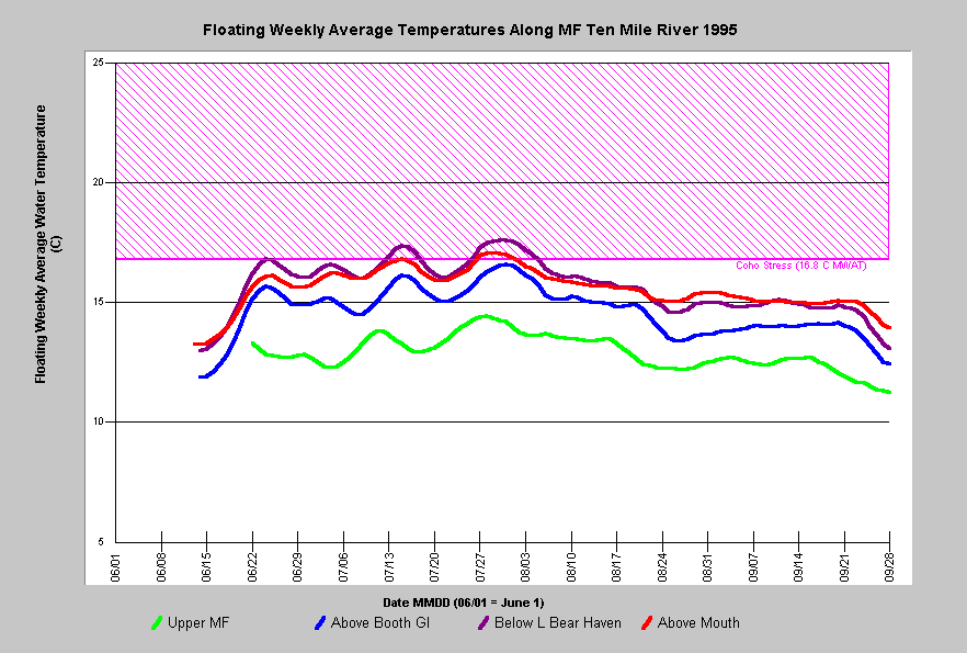 The chart at left shows floating weekly average temperature at four Middle Fork Ten Mile River sites in 1995. Unlike the North Fork, the Middle Fork is not affected by grasslands in mélange terrain at its headwaters and is not naturally warm in upper reaches. The stream begins cool but warm 1.0-2.6 degrees Celsius flowing from site the upper MF to above Booths Gulch, and another 0.1-0.5 degrees before reaching Little Bear Haven Creek at which point the MWAT is 17.5 degrees Celsius, over the threshold know to support coho. The lowest site above the convergence with the North Fork also had temperatures that exceeded the range known to support coho in 1995. Water temperatures at lower mainstem sites may remain under this threshold in cooler years due to fog.
 Floating weekly average temperature in the South Fork Ten Mile River above Redwood Creek exceeded levels suitable for coho salmon juveniles (16.8 degrees C MWAT) in most years between 1993 and 1998. Much of the South Fork downstream of Redwood Creek also has water temperatures too warm to support coho salmon in some years (see next chart). Water temperature at this station remain within ranges suitable for coho in some years more influenced by marine airflow. Warm water temperatures at this location are likely a result of riparian conditions just upstream (see Hypothesis #5).
 This chart shows floating weekly average temperatures at six South Fork Ten Mile locations in 1998. The South Fork is cool enough at Gulch 11 to support coho but becomes too warm above Redwood Creek. The mainstem South Fork warms still further as it travels downstream to the monitoring site near Churchman Creek. Lack of mainstem rearing habitat because of thermal problems in some years greatly restricts carrying capacity for juvenile coho in the Ten Mile River.
Alternative Hypothesis
Mainstem reaches of the Ten Mile River were always warm and coho never predominated there.
Ambrose and Hines (1997) advance two arguments in support of this hypothesis. One asserts that warming in mainstems of the Ten Mile River is caused by channel width, orientation and bedrock type (see Alternative Hypothesis #5B). The other is articulated as follows: "According to Chamberlain et al. (1991, in Meehan ed. 1991) coho salmon spend most of their juvenile rearing stage in tributaries. Because mainstems are not typical utilized by juvenile salmonids during the critical summer period, due to a variety of abiotic and biotic factors, coho salmon presence and abundance may not be limited by lack of available cool water habitat."
Historical information on temperature and presence of coho in mainstem reaches of the Ten Mile River exists only for the South Fork (CDFG, 1961) and only hand held thermometer readings were recorded. Therefore, there is little ability to gauge the range of stream temperatures historically and this hypothesis is impossible to fully test.
Monitoring Trends to Support or Refute the Hypothesis
While this hypothesis has been supported by field data in the Ten Mile River basin (Hines and Ambrose, 1998), it could be further explored with more field studies to confirm or refute the relationship as canopy in the basin recovers and width to depth ratios improve as measures are implemented to control sediment.
References
Ambrose, J., D. Hines, D. Hines, D. Lundby, and J. Drew. 1996. Ten Mile River Watershed 1995 Instream Monitoring Results. Volume I. Georgia-Pacific West Inc. Fort Bragg, CA. 84 pp.
Ambrose, J., and D. Hines. 1997. Ten Mile River Watershed 1996 Instream Monitoring Results. Georgia-Pacific West Inc. Fort Bragg, CA. 55 pp.
Ambrose, J., and D. Hines. 1998. Ten Mile River Watershed 1997 Instream Monitoring Results. Georgia-Pacific West Inc. dba The Timber Company. Fort Bragg, CA. 51 pp.
Armour, C.L. 1991. Guidance for evaluating and recommending temperature regimes to protect fish. U.S. Fish and Wildlife Service. Fort Collins. Biological Report 90(22). 13 p.
California Department of Fish and Game (CDFG). 1961. South Fork Ten Mile River (Ten Mile River tributary) stream survey, September 1961. CDFG unpublished file memo by S.N. Nye. Yountville, CA. 5 pp.
Hines, D.H. and J.M. Ambrose. (In Review). Evaluation of stream temperatures based on observations of juvenile coho salmon in northern California streams. Draft submitted to North American Journal of Fisheries Management. 30 pp.
Welsh, H.H., Jr., G.R. Hodgson, B.C. Harvey, and M.F. Roche. 2001. Distribution of juvenile coho salmon in relation to water temperatures in tributaries of the Mattole River, California. North American Journal of Fisheries Management 21(3):464-470. [335k] .