| Bibliography | Background | Hypotheses | Home | |
| Bibliography | Background | Hypotheses | Home | |
The property of soils can profoundly affect erosion risk and can, therefore, be useful in judging potential impacts of land use during watershed assessment. KRIS projects use the U.S.D.A. Natural Resource Conservation Service (NRCS) erodibility index (kkfact) to understand potential soil loss, which is based on detachability of soil particles and steepness of slope. Unfortunately, much available soil data is a at very small scale (1:250,000) and only useful for regional analysis (Figure 1).
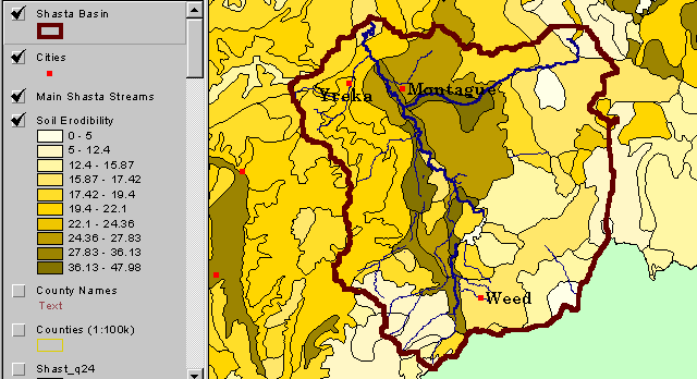 |
Figure 1. This small scale NRCS soils map (1:250000) shows erodibility of the Shasta Valley in northern California. The brown areas indicate higher soil erodibility, which is due to a giant, ancient debris slide from a volcano that used to stand next to Mt. Shasta. Very little "ground truthing" has been done, so this map is of limited use for local planning. |
Detailed soil data (1:24000) are available from NRCS for some geographic areas where KRIS projects have been carried out (Figure 2), such as Mendocino County in northwestern California. NRCS (1998) described the soils data provided for use in the KRIS Noyo Map project as follows:
"This data set is a digital soil survey and generally is the most detailed level of soil geographic data developed by the National Cooperative Soil Survey. The information was prepared by digitizing maps, by compiling information onto a planimetric correct base and digitizing, or by revising digitized maps using remotely sensed and other information.
This data set consists of geo-referenced digital map data and attribute data. The map data are in a 7.5 minute format and include a detailed, field verified inventory of soils and non-soil areas that normally occur in a repeatable pattern on the landscape and that can be cartographically shown at the scale mapped. A special soil features layer (point and line features) is optional. This layer displays the location of features too small to delineate at the mapping scale, but they are large enough and contrasting enough to significantly influence use and management. The soil map units are linked to attributes in the Map Unit Interpretations Record relational database, which gives the proportionate extent of the component soils and their properties."
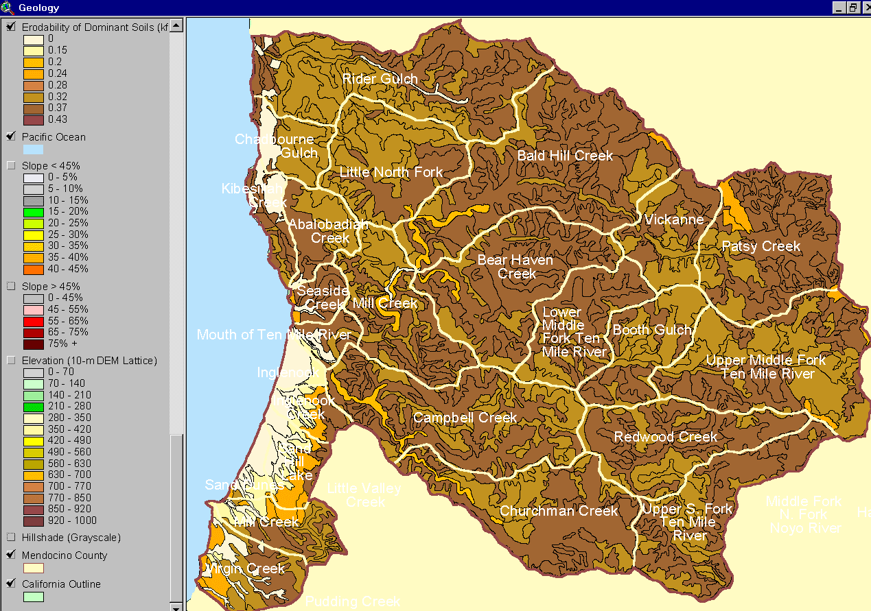 |
Figure 2. The image at left shows the soil erodibility in the Ten Mile River basin according to the NRCS 1:24000 Mendocino County soil map. The theme displayed is the erodibility rating (kffact) based on detachability of soil particles and slope steepness. Much of the basin is highly unstable, but areas of milder terrain in the north and river bottoms register lower soil erosion risk. |
NRCS is concerned about proper use of its data in land use management decisions and offers a disclaimer for potential problems and the the limits of fair use (NRCS note).
![]()
References
Natural Resources Conservation Service (NRCS). 1998. Soil Survey Geographic (SSURGO) database for Mendocino County, Western Part, California. NRCS State Soil Scientist, Davis, CA.
![]()
|
Table of Contents for Background Pages |
|||||
| Stream Conditions: | Water Quality | Sediment | Riparian | Big Wood | Habitat Types |
| Watershed Conditions: | Vegetation Types | Slope Stability | Roads & Erosion | Cumulative Impacts | Urbanization |
| Fish & Aquatic Life: | Fish Populations | Amphibians | Aquatic Insects | Hatcheries | Fish Disease |
| Restoration: | Stream Clearance | In-stream Structures | Riparian | Watershed | Strategy |
| Geology / Hydrology: | Geology | Soils | Precipitation | Stream Flow | Channel Processes |
| Policy & Regulation | ESA | TMDL | Forest Rules | 1603 Permits | Water Rights |
| www.krisweb.com |