 |
 |
| Background | Hypotheses | Bibliography | Maps | Home |
|
|
| Background | Hypotheses | Bibliography | Maps | Home |
KRIS Ten Mile Map Project: Geology View
![]()
Geology spatial data were mostly obtained from the California Department of Conservation, Division of Mines and Geology (DMG). Major themes in this view include: annual rainfall modeled on different periods (1900-1960 & 1961-1990), locations of small slides, active and dormant slides, earthflows, amphitheaters (landslide precursors), inner gorges, shear zones, and torrent tracks. Also included are bedrock geology, colored hillshade elevation at 10 meter resolution, and associated slope (indexing a range of slope risk). Matthews (2000) also provided ArcView projects, including landslide locations. Stream gradient developed from 10 meter DEMs occurs as a theme in the Geology View because it provides insight into sediment transport. Soils data are also include in this view to show erodibility of the dominant soils (kkfact), derived from Natural Resources Conservation Service (1998) data. Dr. Jan Derksen of the KRIS team also produces shallow landslide stability maps (Montgomery and Dietrich, 1994) based on 10 meter data provided by the California Department of Forestry. These offer coarse assessment of landslide risk from a basin wide perspective (for more information see Shallow Landslide Modeling).
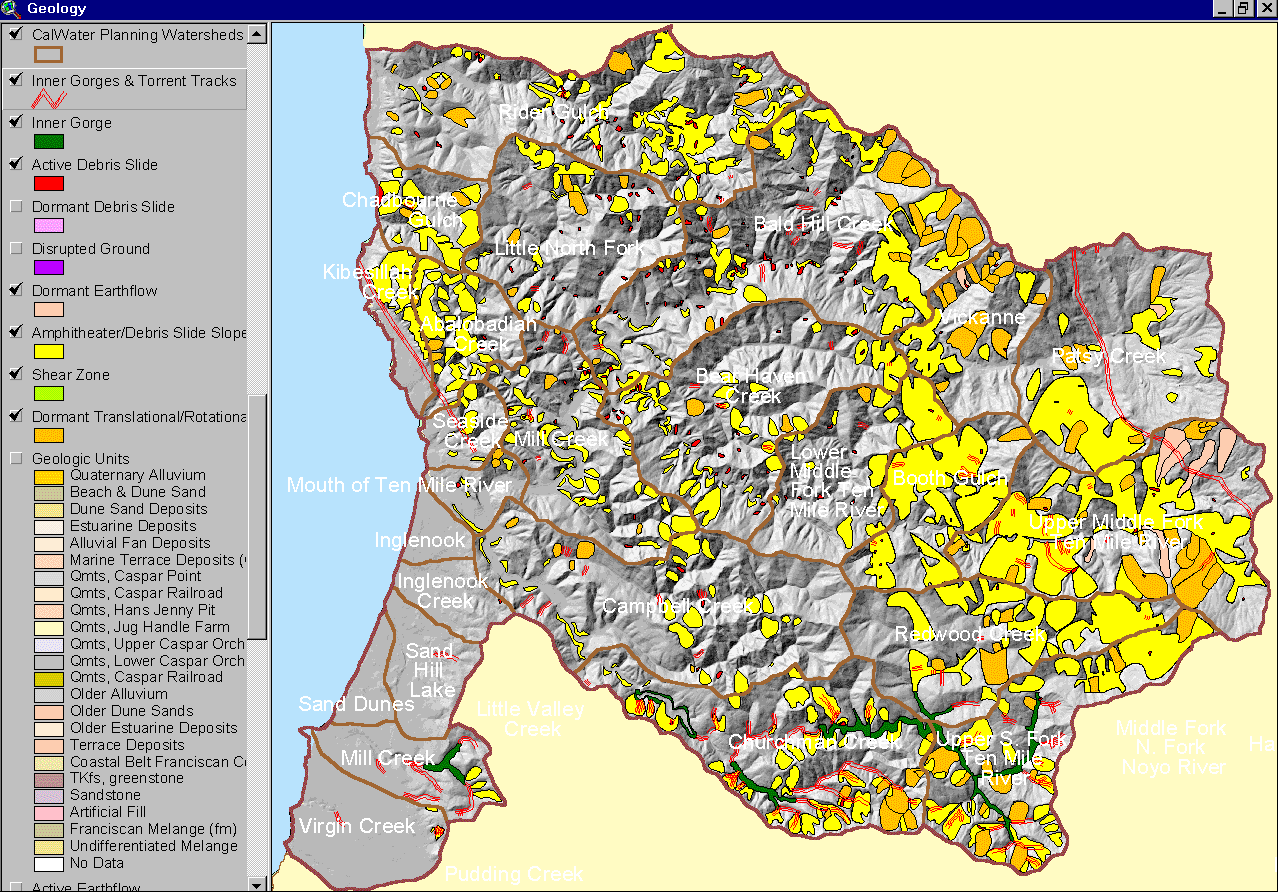 |
The image at left shows a map of geohazards for the Ten Mile River basin supplied by the California Division of Mines and Geology. Maps with active and dormant landslide features are useful for understanding erosion risk during watershed assessment or when planning land use activities. See Geology. |
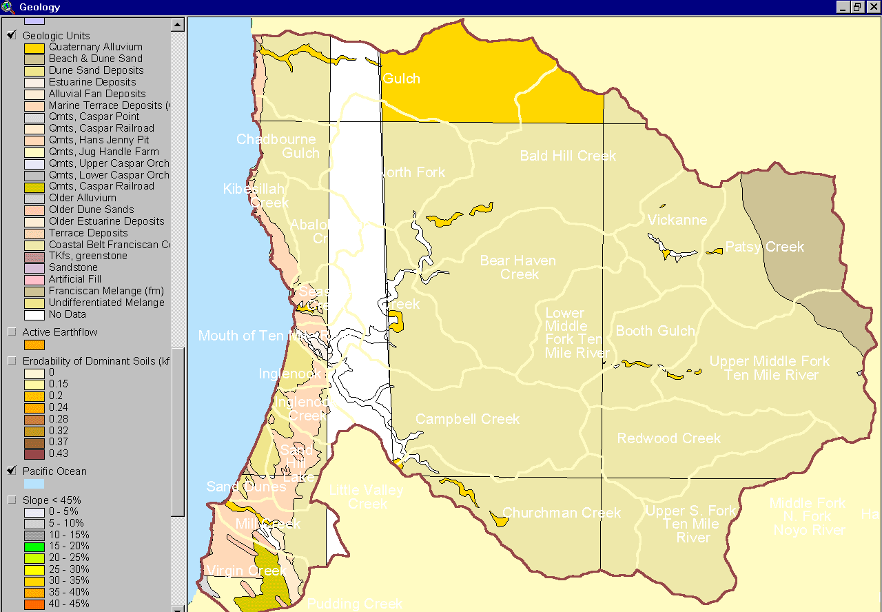 |
The map image at left shows the bedrock geology of the Ten Mile River basin provided by the California Division of Mines and Geology (Bedrosian, 1986). The western portion of the watershed is mostly uplifted marine sediment and sand dunes. To the east is the Coastal Belt Franciscan Formation intrudes into the upper North Fork near Patsy Creek. (See CDMG metadata). |
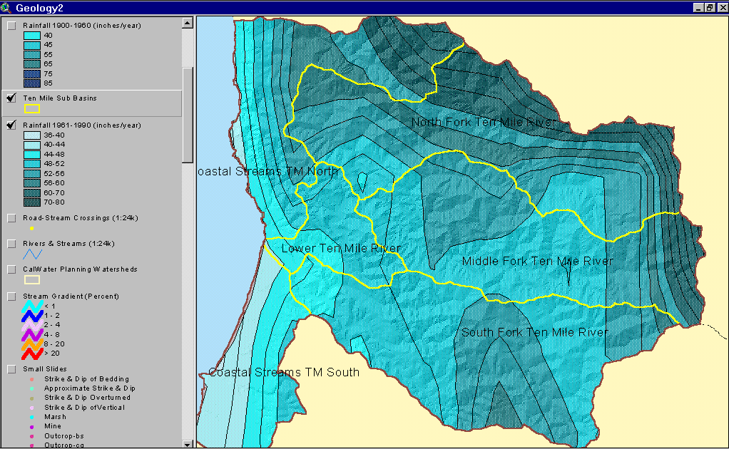 |
This image shows the rainfall isopleths for the Ten Mile River watershed. While rainfall on the coast is only about 40 inches per year, interior basin areas receive as much as 70 to 80 inches. This layer was generated by the Oregon Climate Service at Oregon State University from 1961-1990 rainfall data. |
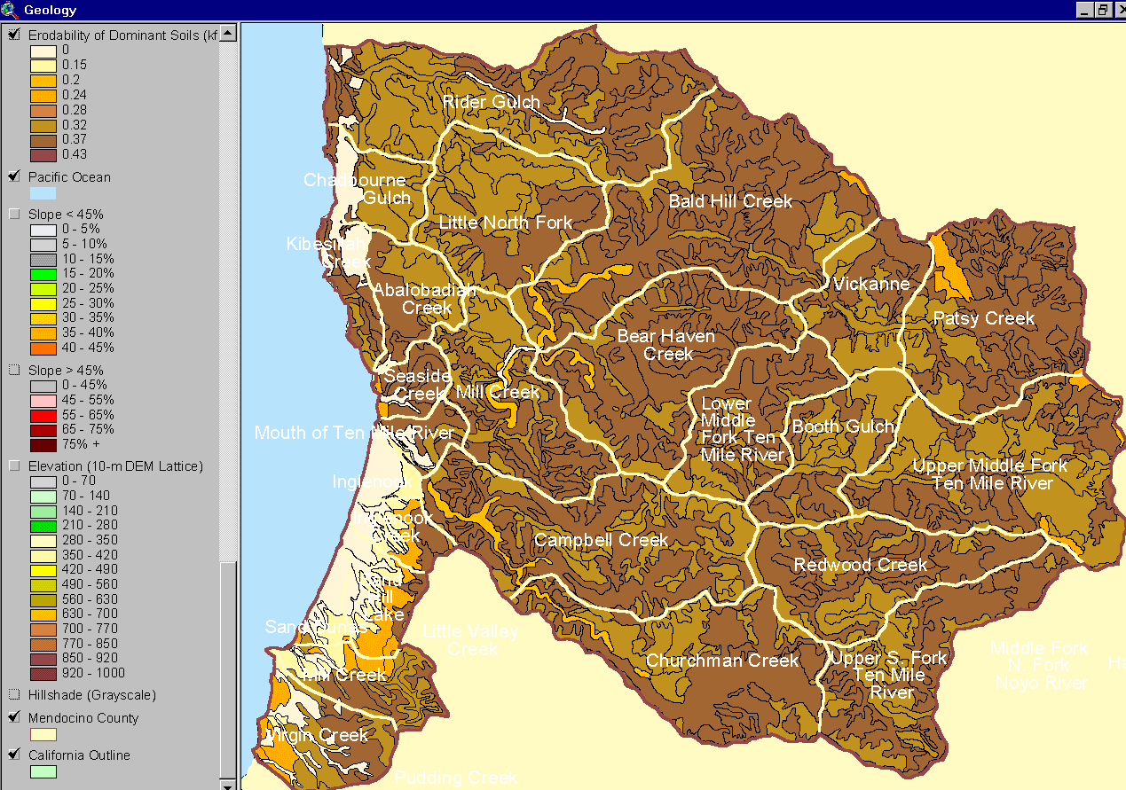 |
The image at left shows the soil erodibility in the Ten Mile River basin according to a Natural Resource Conservation Service 1:24000 Mendocino County soil map. The erodibility rating is based on detachability of soil particles and slope steepness (kkfact). |
|
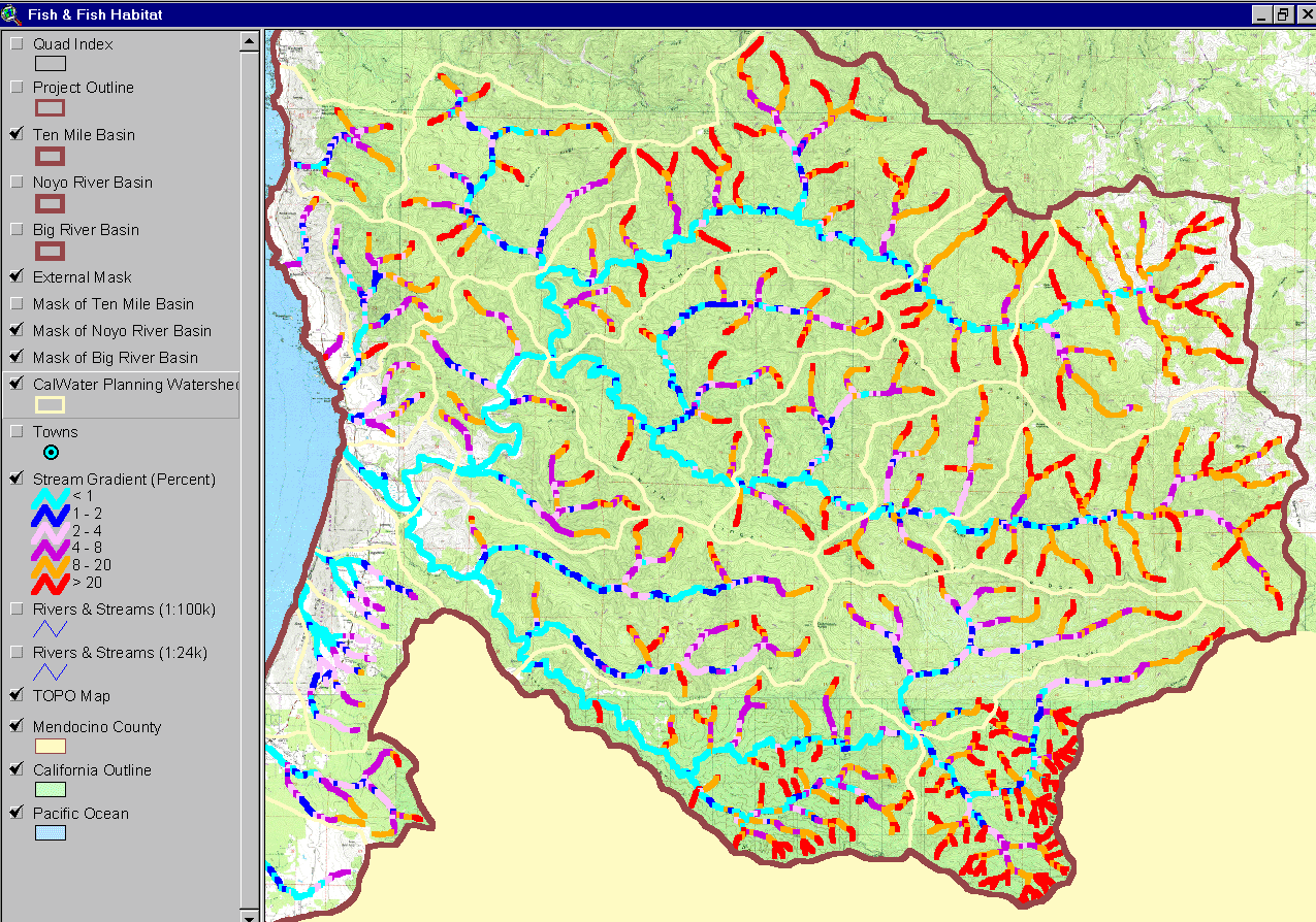
The stream gradient theme for the Ten Mile River basin is shown at left with a USGS topographical map backdrop. Stream reaches colored red are supply reaches where sediment is conveyed when delivered from hillslopes. Reaches with a gradient more than 4% are transport reaches and those less than 4% are response reaches. In low gradient reaches, spawning gravel and big wood would have built up under pre-disturbance conditions, making it optimal salmon habitat. Derived from 10 meter DEM supplied by CDF FRAP. |
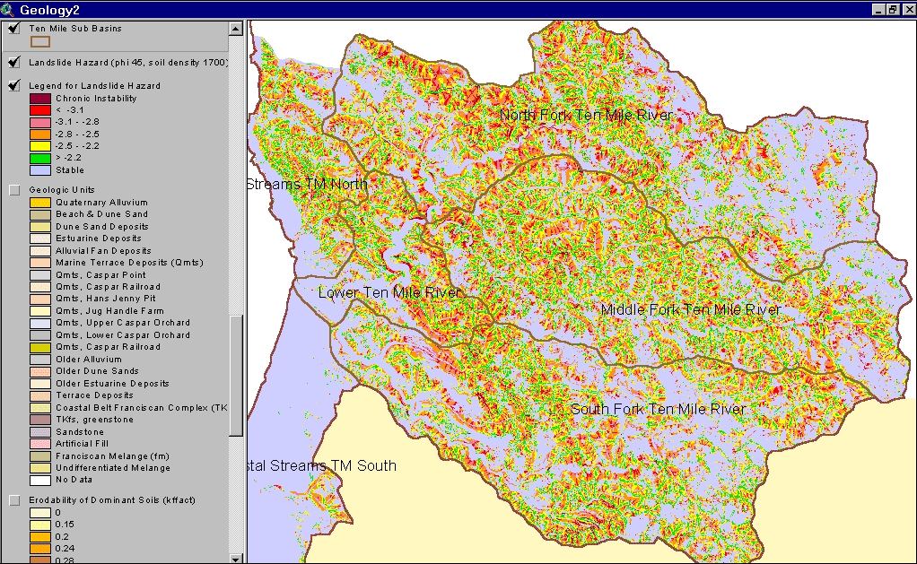 |
The map at left shows a landslide hazard map for the Ten Mile River basin. Areas of highest risk have low, negative scores. Dietrich (Dietrich, 1998) requests that users of the SHALSTAB model employ standard soil parameters he developed in his 1998 validation study to facilitate uniform results. He tentatively proposes a "high hazard" classification for scores equal to or below -2.8 produced by SHALSTAB with standard soil parameters and 10 meter digital elevation data. There appears to be higher risk areas in the North Fork than in other basins. |
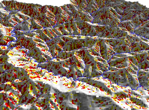 |
The map at left shows a 3D landslide hazard map for the lower North Fork and Middle Fork Ten Mile River. Areas of highest risk (scores below -2.8) are concentrated in the North Fork and are shown in red; areas with medium risks are shown in yellow (scores below -2.5). For more information see Shallow Landslides in the KRIS Ten Mile. |
![]()
References
Bedrossian, T. L. 1986. Watershed Mapping in Northern California, an update. California Geology, February 1986.
Matthews, Graham and Associates. 2000a. Sediment source analysis and preliminary sediment budget for the Ten Mile River, Mendocino County, CA. Prepared for Tetra Tech, Inc. VOLUME 1: Text, Tables, and Figures. Fairfax, VA. 143 pp.
Matthews, Graham and Associates. 2000b. Sediment source analysis and preliminary sediment budget for the Ten Mile River, Mendocino County, CA. Prepared for Tetra Tech, Inc. VOLUME 2: Appendices. Fairfax, VA. 59 pp.
Montgomery, D.R. and W.E. Dietrich. 1994. A physically based model for the topographic control on shallow landsliding. Water Resources Research, Vol.30, No.4. April 1994. Pages 1153-1171.
Natural Resources Conservation Service (NRCS). 1998. Soil Survey Geographic (SSURGO) database for Mendocino County, Western Part, California. NRCS State Soil Scientist, Davis, CA.
KRIS Ten Mile Map Views:
| www.krisweb.com |